The Iolaos whiteboard software includes numerous tools and educational resources tailored for classroom use on ENI. Among these resources are world maps that can benefit both geography and life sciences teachers. In this brief article, we explain how to find these maps, the possible actions you can perform, and we provide an overview of the available map catalog.
Where to Find Maps in Iolaos? (↑)
- Navigate to the Tools section.
- Click on the Toolbar tab, then select Solar System.
- Choose the Earth.
- In the toolbar on the right, click the map icon to display the maps.
![Tutorial: How to Find Maps in the Iolaos Whiteboard Software Tutorial: How to Find Maps in the Iolaos Whiteboard Software](https://speechi.com/wp-content/uploads/2024/12/iolaos-trouver-cartes.gif)
![iolaos-afficher-cartes-1](https://speechi.com/wp-content/uploads/2024/12/iolaos-afficher-cartes-1.jpg)
Transforming the 3D Globe into a Flat Map (↑)
- Click the 2D button to transform the globe into a flat map.
- Remove the descriptive card of the Earth by clicking the blue icon at the bottom left.
- Zoom in or out by clicking the -/+ buttons.
- Return to the default view by clicking the icon to the right of the + button.
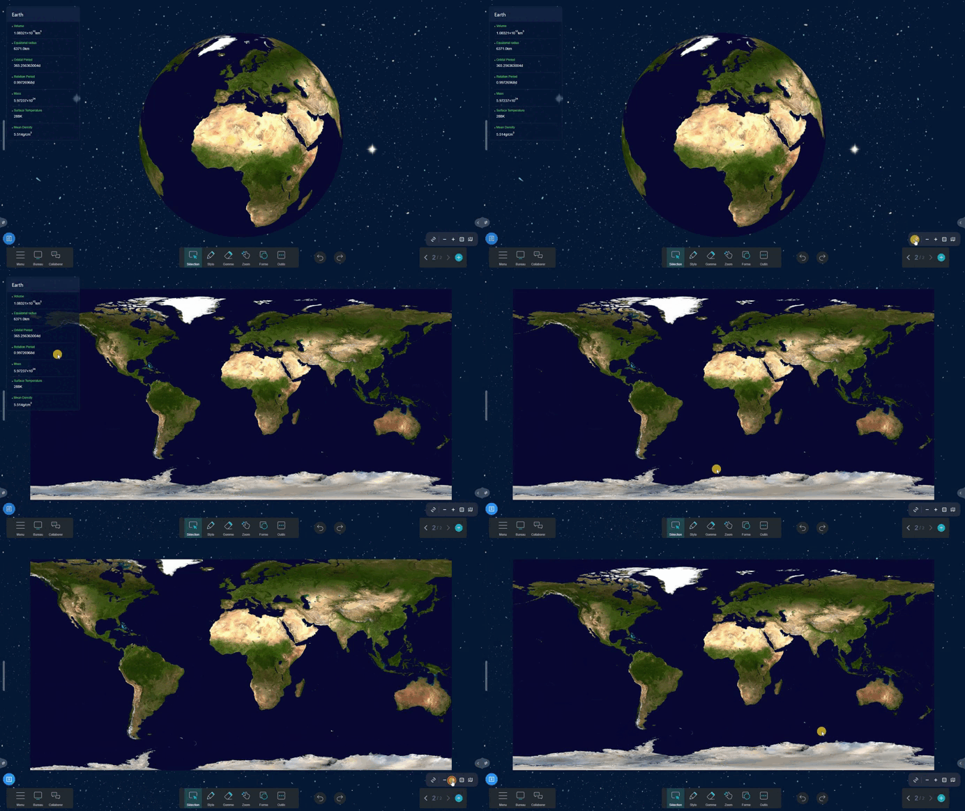
![Tutorial: How to Transform the 3D Globe into a Flat Map Tutorial: How to Transform the 3D Globe into a Flat Map](https://speechi.com/wp-content/uploads/2024/12/iolaos-carte-planisphere.gif)
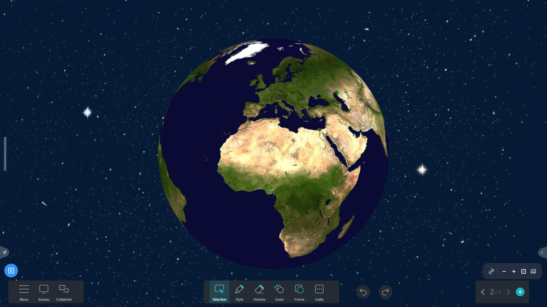
![World Map from Space in Iolaos (3D) World Map from Space in Iolaos (3D)](https://speechi.com/wp-content/uploads/2024/12/1-iolaos-carte-espace-3D.png)
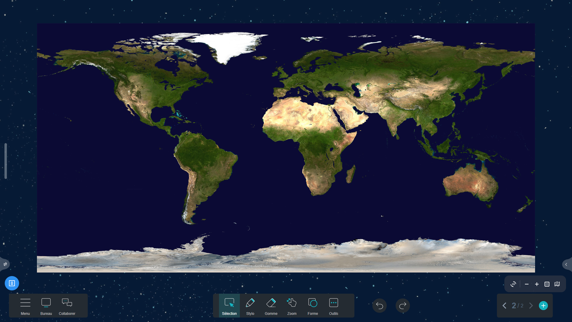
![World Map from Space in Iolaos (2D) World Map from Space in Iolaos (2D)](https://speechi.com/wp-content/uploads/2024/12/1-iolaos-carte-espace-2D.png)
2. Countries Map (↑)
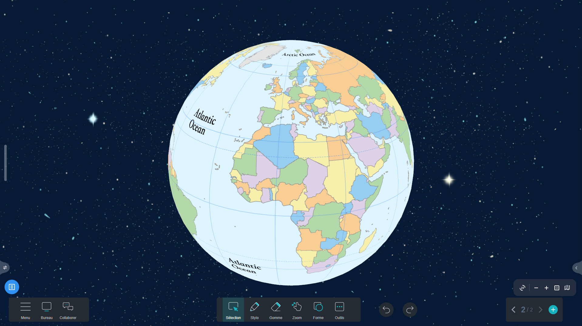
![Countries Map in Iolaos (3D) Countries Map in Iolaos (3D)](https://speechi.com/wp-content/uploads/2024/12/2-iolaos-carte-pays-3D.png)
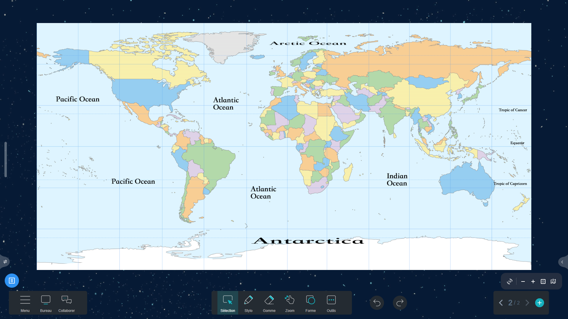
![Countries Map in Iolaos (2D) Countries Map in Iolaos (2D)](https://speechi.com/wp-content/uploads/2024/12/2-iolaos-carte-pays-2D.png)
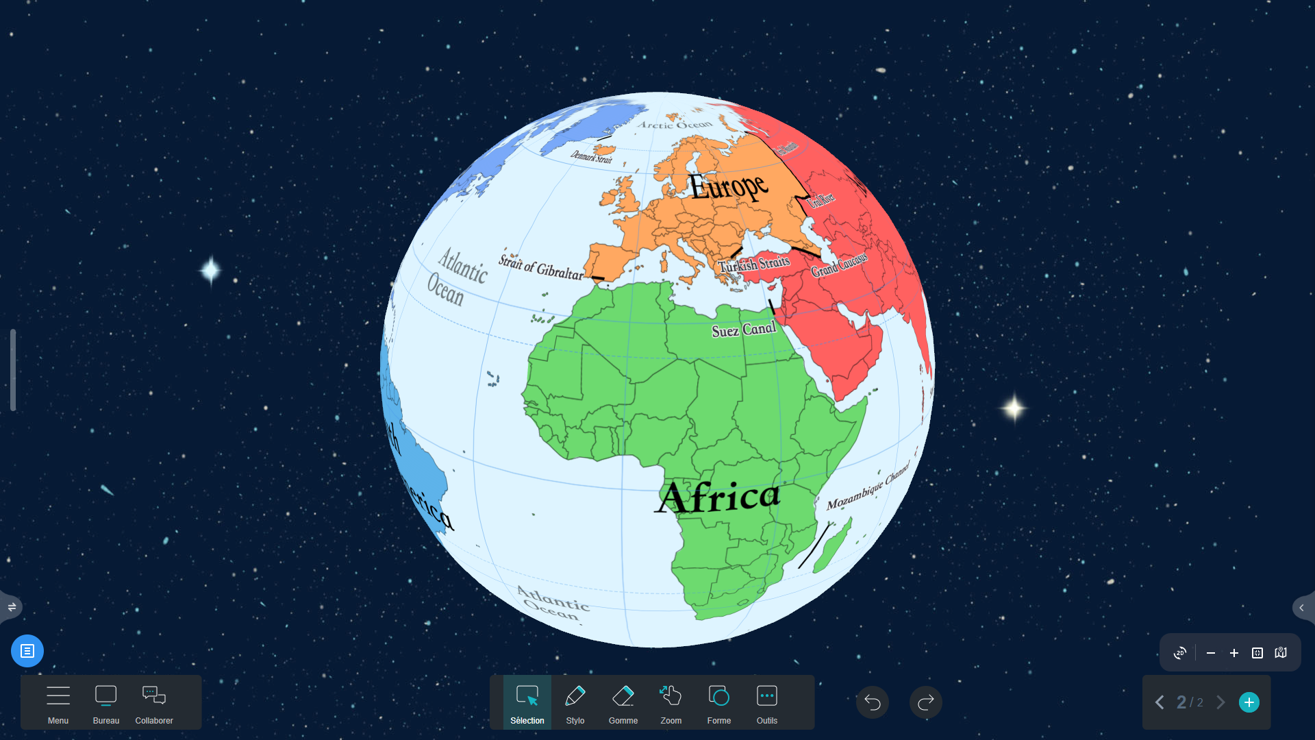
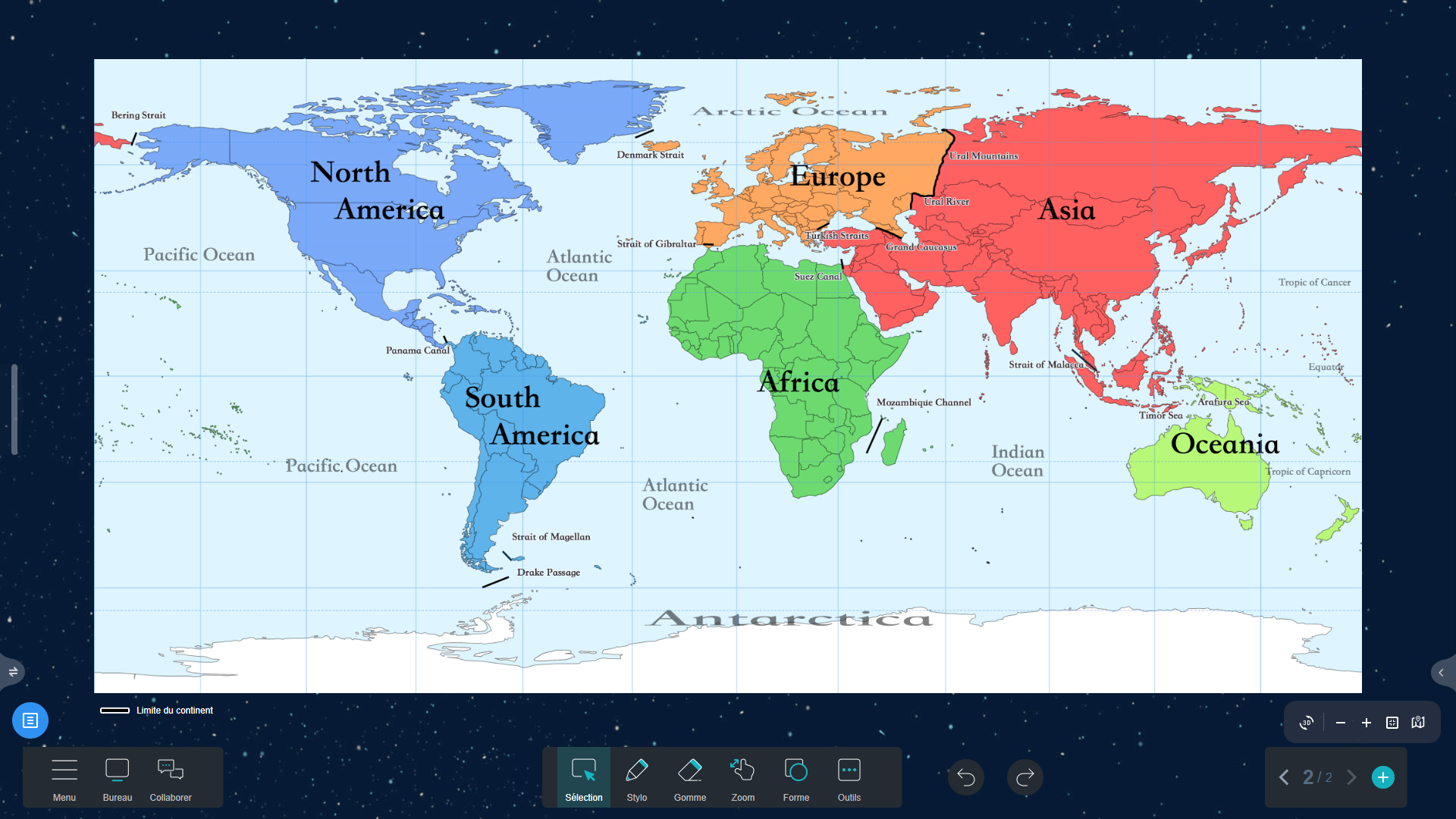
3. Continents Map (↑)
![Continents Map in Iolaos (3D) Continents Map in Iolaos (3D)](https://speechi.com/wp-content/uploads/2024/12/3-iolaos-carte-continents-3D.png)
![Continents Map in Iolaos (2D) Continents Map in Iolaos (2D)](https://speechi.com/wp-content/uploads/2024/12/3-iolaos-carte-continents-2D.png)
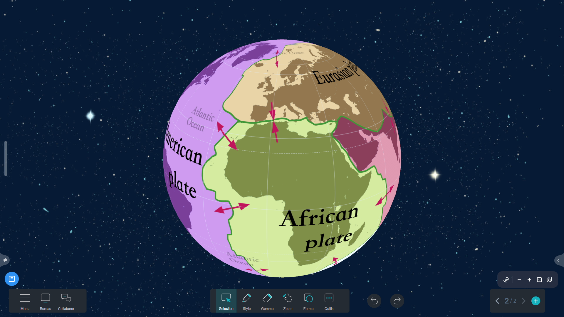
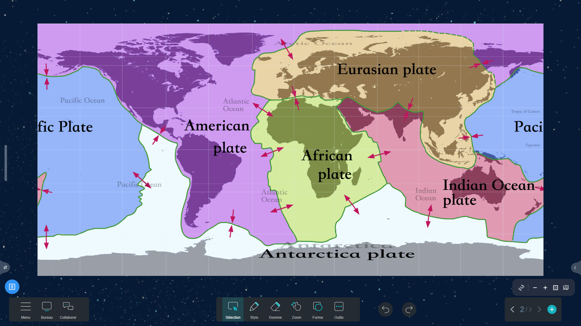
4. Tectonic Plates Map (↑)
![Tectonic Plates Map in Iolaos (3D) Tectonic Plates Map in Iolaos (3D)](https://speechi.com/wp-content/uploads/2024/12/4-iolaos-carte-plaques-3D.png)
![Tectonic Plates Map in Iolaos (2D) Tectonic Plates Map in Iolaos (2D)](https://speechi.com/wp-content/uploads/2024/12/4-iolaos-carte-plaques-2D.png)
5. Climate Map (↑)
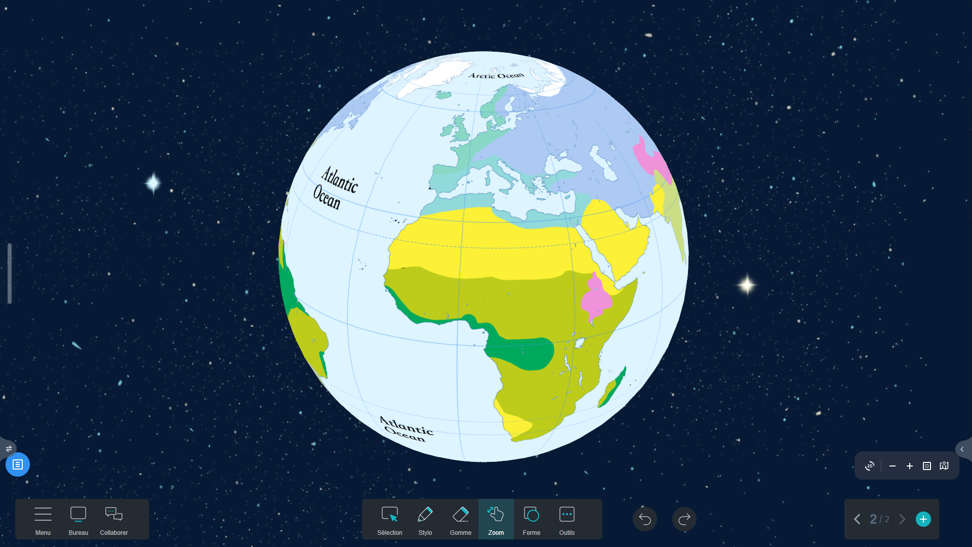
![Climate Map in Iolaos (3D) Climate Map in Iolaos (3D)](https://speechi.com/wp-content/uploads/2024/12/5-iolaos-carte-climat-3D.png)
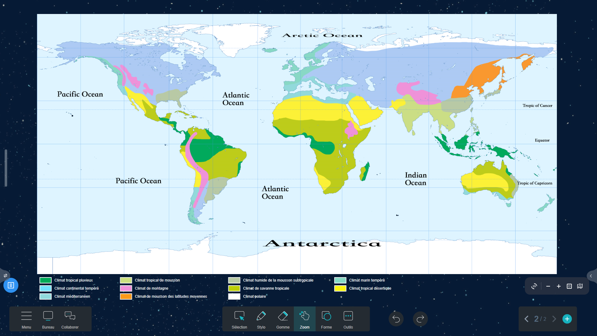
![Climate Map in Iolaos (2D) Climate Map in Iolaos (2D)](https://speechi.com/wp-content/uploads/2024/12/5-iolaos-carte-climat-2D.png)
6. Köppen Climate Classification Map (↑)
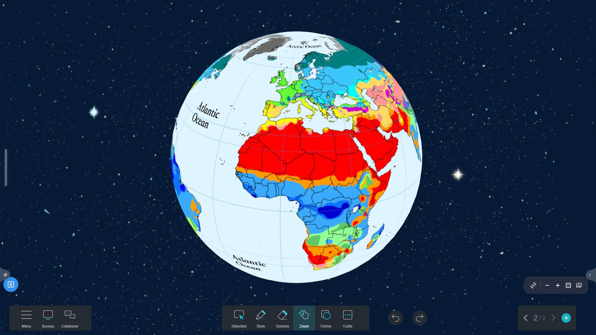
![Köppen Climate Classification Map in Iolaos (3D) Köppen Climate Classification Map in Iolaos (3D)](https://speechi.com/wp-content/uploads/2024/12/6-iolaos-carte-koppen-3D.png)
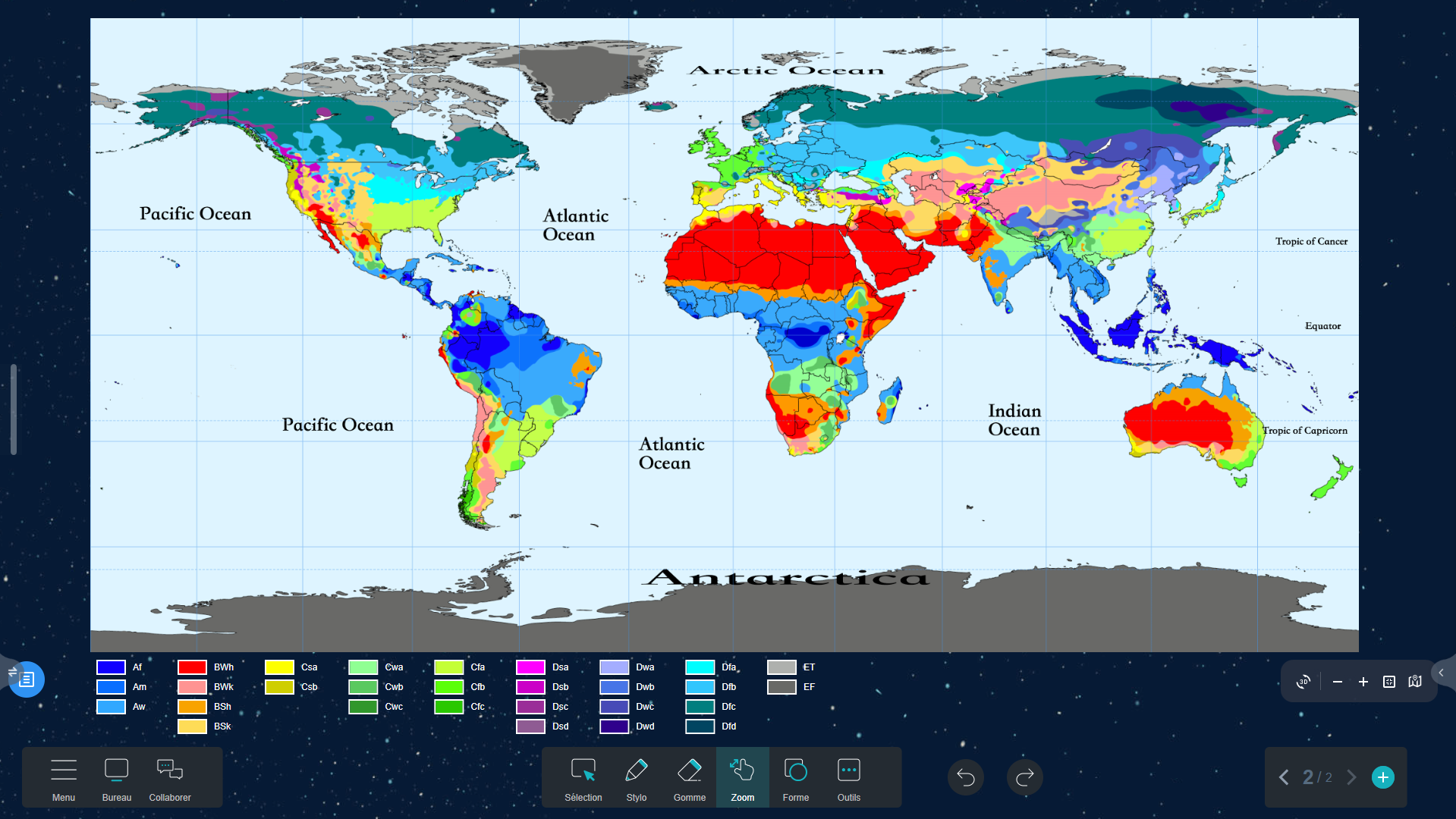
![Köppen Climate Classification Map in Iolaos (2D) Köppen Climate Classification Map in Iolaos (2D)](https://speechi.com/wp-content/uploads/2024/12/6-iolaos-carte-koppen-2D.png)
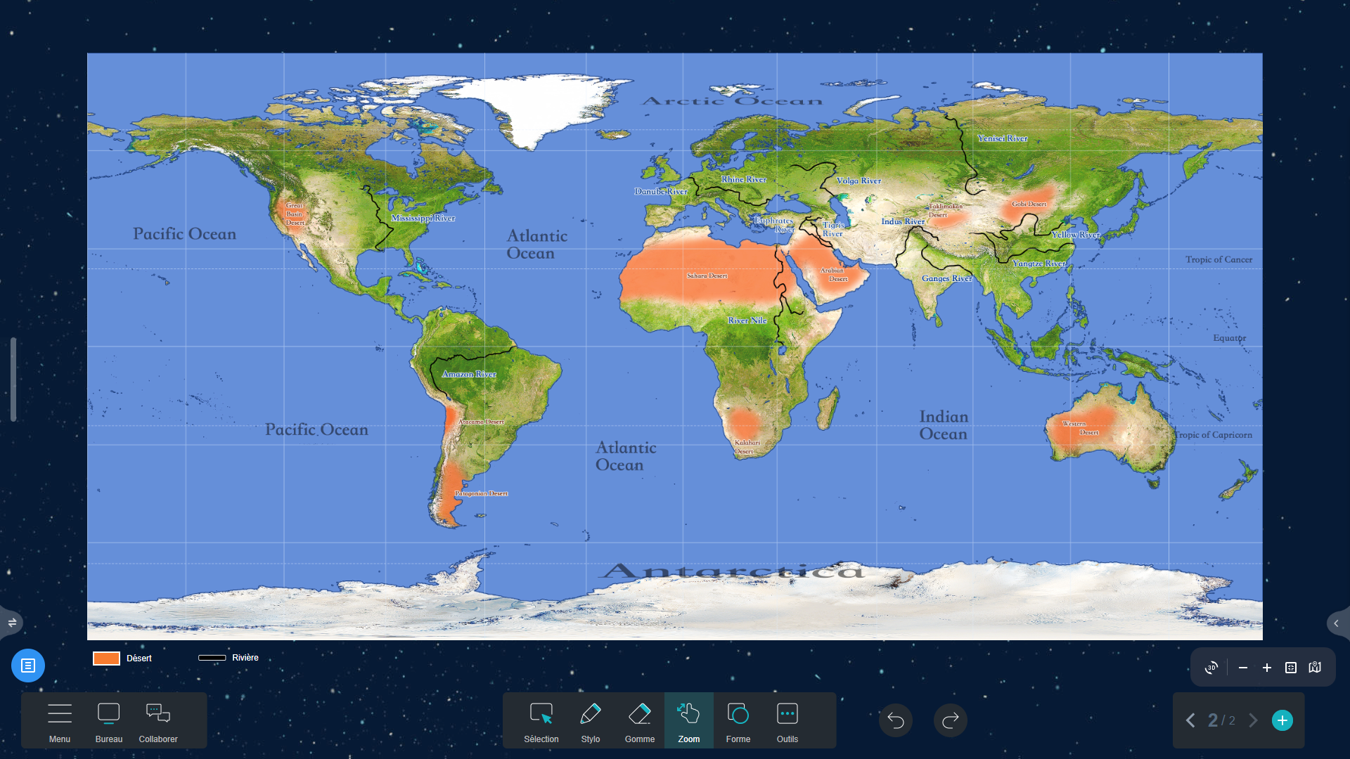
7. Deserts and Rivers Map (↑)
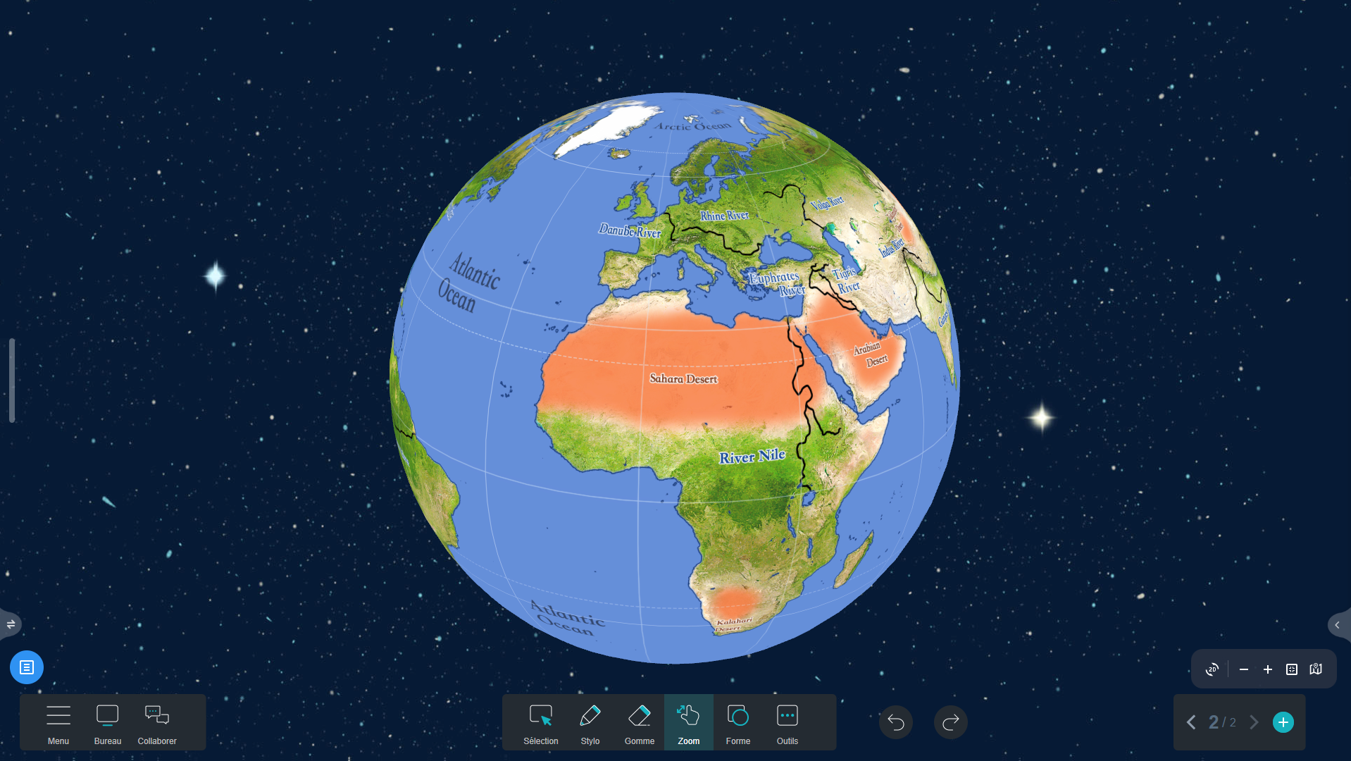
![Deserts and Rivers Map in Iolaos (3D) Deserts and Rivers Map in Iolaos (3D)](https://speechi.com/wp-content/uploads/2024/12/7-iolaos-carte-desert-3D.png)
![Deserts and Rivers Map in Iolaos (2D) Deserts and Rivers Map in Iolaos (2D)](https://speechi.com/wp-content/uploads/2024/12/7-iolaos-carte-desert-2D.png)
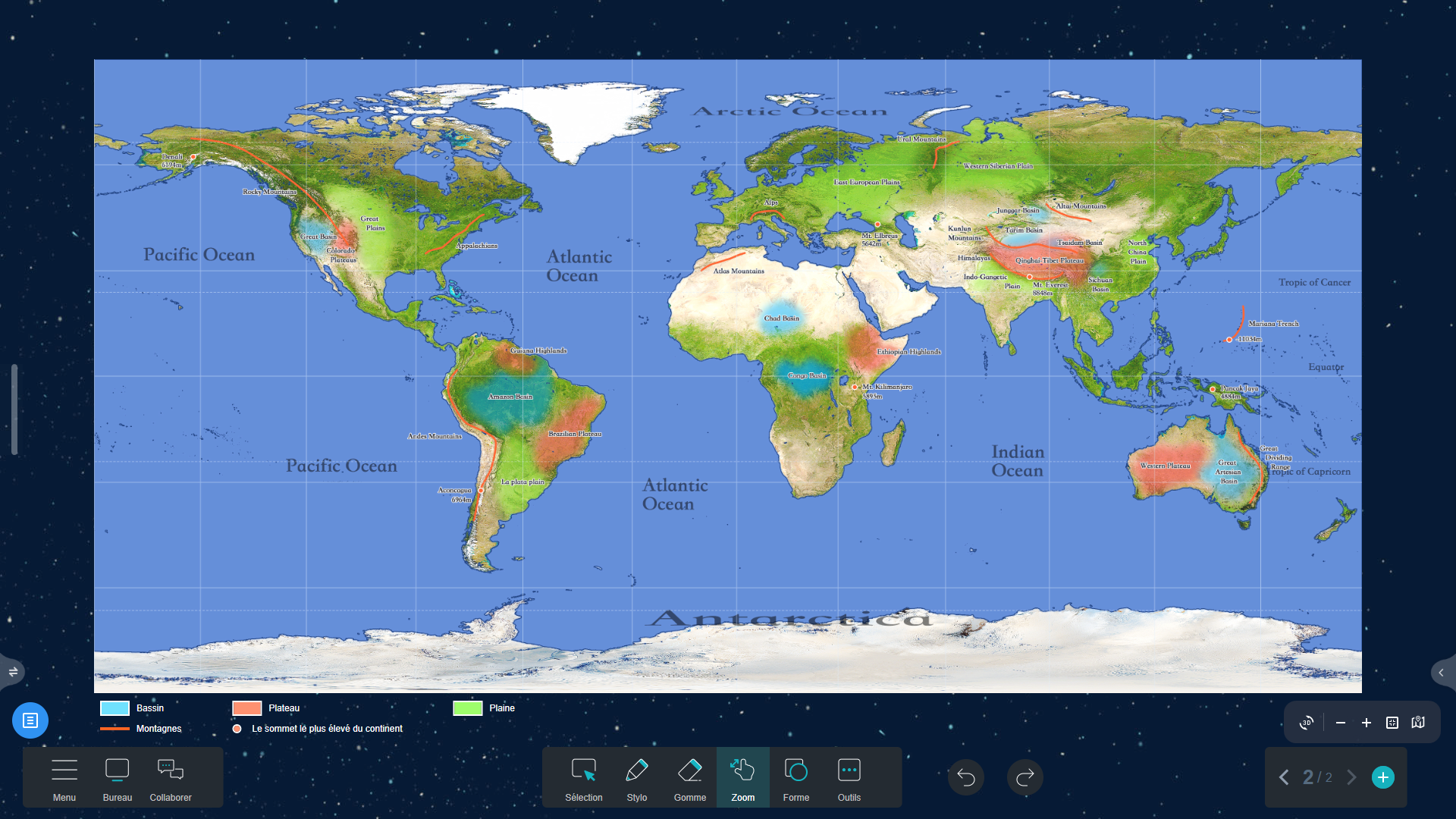
8. Basins, Mountains, Plateaus, and Plains Map (↑)
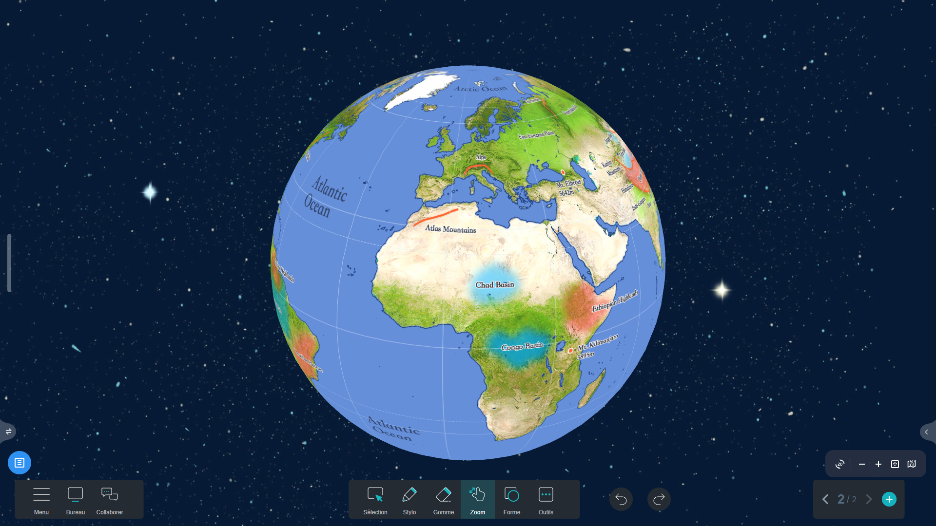
![Basins, Mountains, Plateaus, and Plains Map in Iolaos (3D) Basins, Mountains, Plateaus, and Plains Map in Iolaos (3D)](https://speechi.com/wp-content/uploads/2024/12/8-iolaos-carte-bassin-3D.png)
![Basins, Mountains, Plateaus, and Plains Map in Iolaos (2D) Basins, Mountains, Plateaus, and Plains Map in Iolaos (2D)](https://speechi.com/wp-content/uploads/2024/12/8-iolaos-carte-bassin-2D.png)
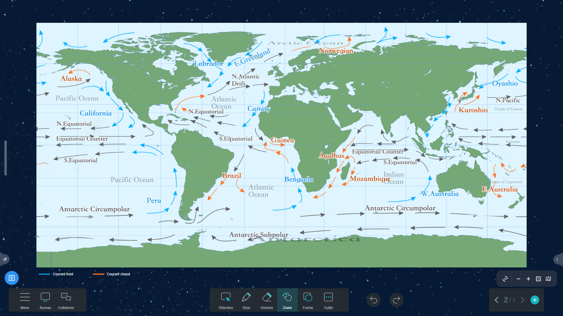
9. Warm and Cold Ocean Currents Map (↑)
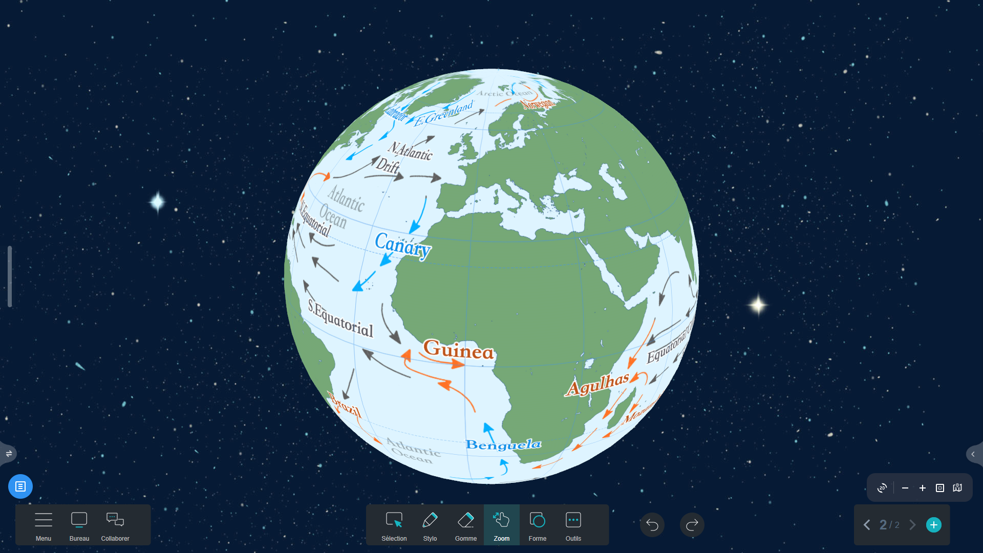
![Warm and Cold Ocean Currents Map in Iolaos (3D) Warm and Cold Ocean Currents Map in Iolaos (3D)](https://speechi.com/wp-content/uploads/2024/12/9-iolaos-carte-courants-3D.png)
![Warm and Cold Ocean Currents Map (2D) Warm and Cold Ocean Currents Map (2D)](https://speechi.com/wp-content/uploads/2024/12/9-iolaos-carte-courants-2D.png)
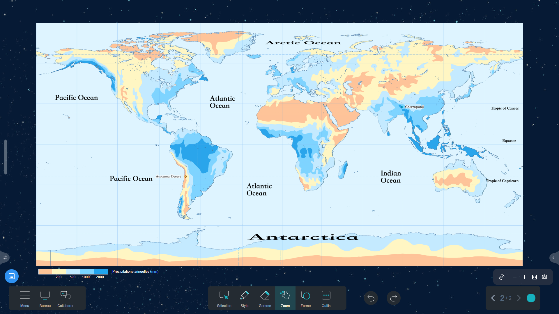
10. Annual Precipitation Map (mm) (↑)
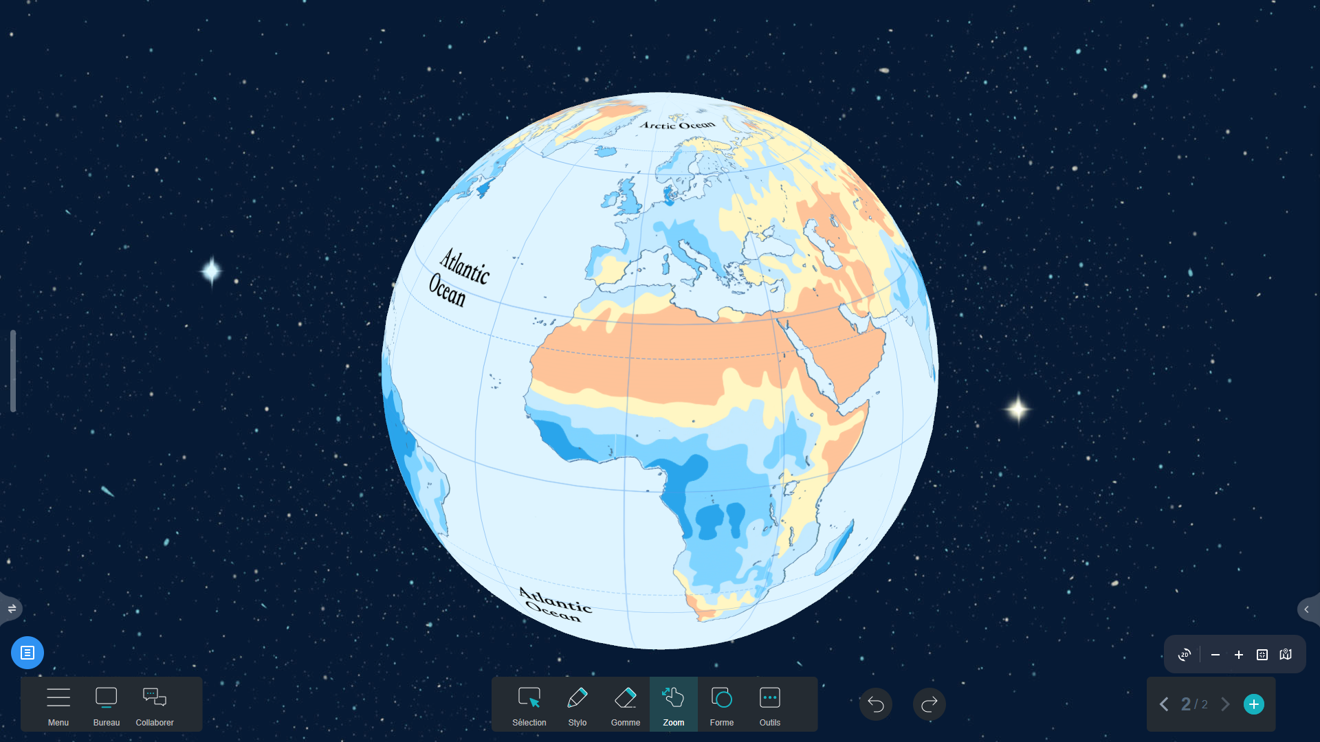
![Annual Precipitation Map in Iolaos (mm) (3D) Annual Precipitation Map in Iolaos (mm) (3D)](https://speechi.com/wp-content/uploads/2024/12/10-iolaos-carte-pluie-3D.png)
![Annual Precipitation Map in Iolaos (mm) (2D) Annual Precipitation Map in Iolaos (mm) (2D)](https://speechi.com/wp-content/uploads/2024/12/10-iolaos-carte-pluie-2D.png)
For more articles on Iolaos
- – Teach Writing on the Interactive Display with Iolaos Whiteboard Software
- – Iolaos Tutorial No. 1: Preparing Your First Teaching Materials on Iolaos (PC)
- – Iolaos Tutorial No. 2: Creating Interactive Exercises for Your Classroom Interactive Display
- – Opening Flipchart Files on the Iolaos Whiteboard Software
- – IOLAOS : the 3 advantages of our new educational software for teaching on a Speechi interactive display