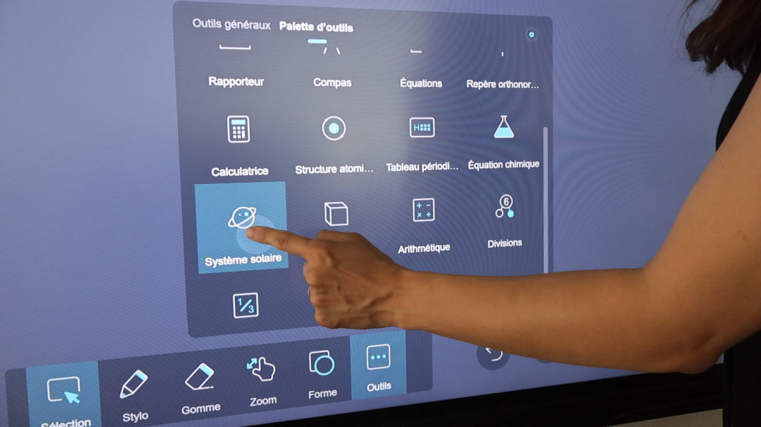
What science teacher hasn’t dreamed of teaching their students about the solar system with a tool powerful enough not only to make the study concrete and interactive, but also to reveal its beauty? Through this short tutorial, let’s discover a whiteboard tool in Iolaos that will be appreciated by both students and physics/biology teachers.
As a reminder, Iolaos is a whiteboard software for PC, compatible with interactive display. We already took a quick tour of its solar system module when exploring maps related to planet Earth in the article The Hidden Features of Maps in Iolaos (Geography and Life Sciences). You’ll find links to all other Iolaos tutorials available on this blog at the end of this article (↓).
Table of Contents
2. Interactive presentations of the Solar System (↑)
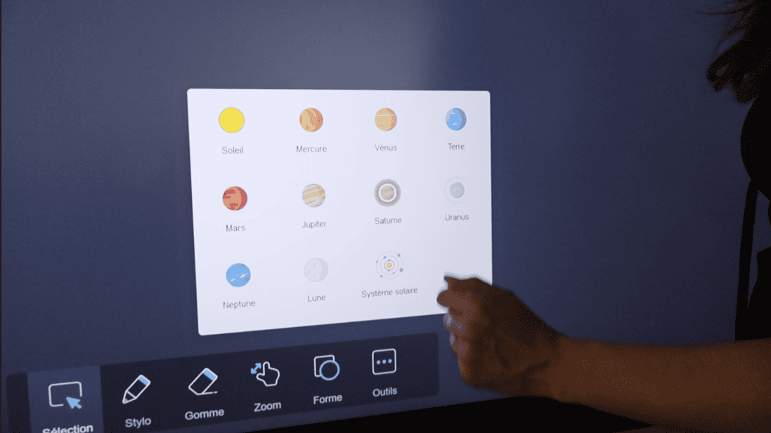
- The Solar System tool in Iolaos offers 10 interactive presentations of the Sun and its planets, along with an interactive map of our solar system.
- When you click on one of the interactive presentations, it opens in a new slide that you are automatically switched to.
3. “Manipulating” the planets (↑)
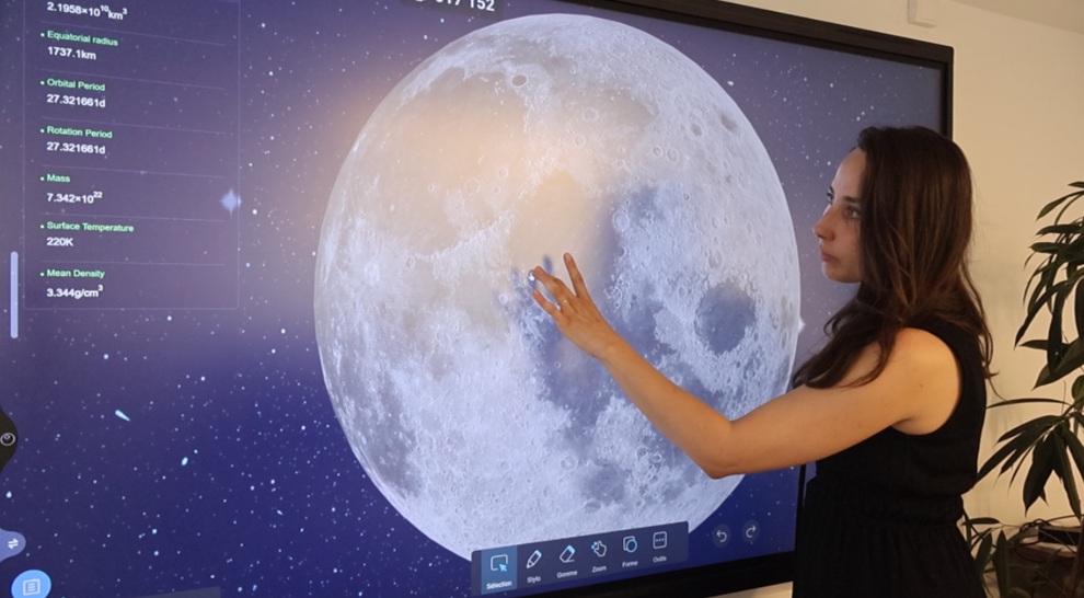
Rotate the planet, zoom in, or zoom out with your fingers just as you would on a tablet.
Make sure your fingers are placed directly on the planet (and not next to it) to perform these actions!
4. Hiding / displaying the planet’s info sheet (↑)
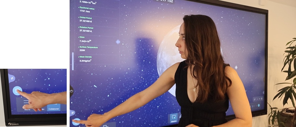
- The Sun and each planet come with an information sheet listing the following data: volume, equatorial radius, orbital period, rotation period, mass, surface temperature, average density.
- If you want to hide this info sheet (it can get in the way when switching to the map projection view), simply click the blue button at the bottom of the sheet (click it again to display the sheet again).
5. Switching between 3D planet view and map projection (↑)
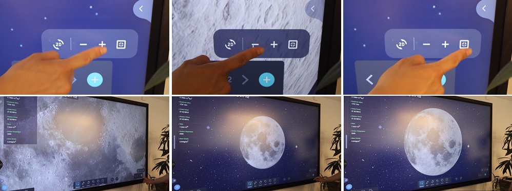
At the bottom right of the interactive presentation, click the 2D button to display the planet as a “map projection,” and the 3D button to return to the 3D view.

6. Zooming in / out on the planet (↑)
At the bottom right of the interactive presentation, click the [+] button to zoom in on the planet, the [-] button to zoom out, and the last button to reset to the default view.
7. Iolaos’ interactive solar system map (↑)
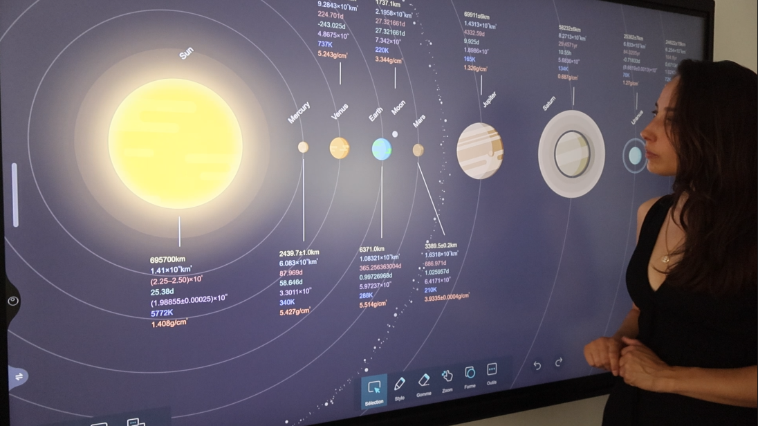
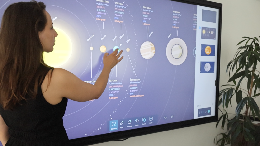
An interactive map
The interactive solar system map works just like the menu described in (2).
- Click on a planet on the map to open its interactive presentation. This will appear in a new slide, which you are automatically switched to.
- To go back to the solar system map, simply display the slides by clicking the menu at the bottom right and selecting it again.
Managing displayed information
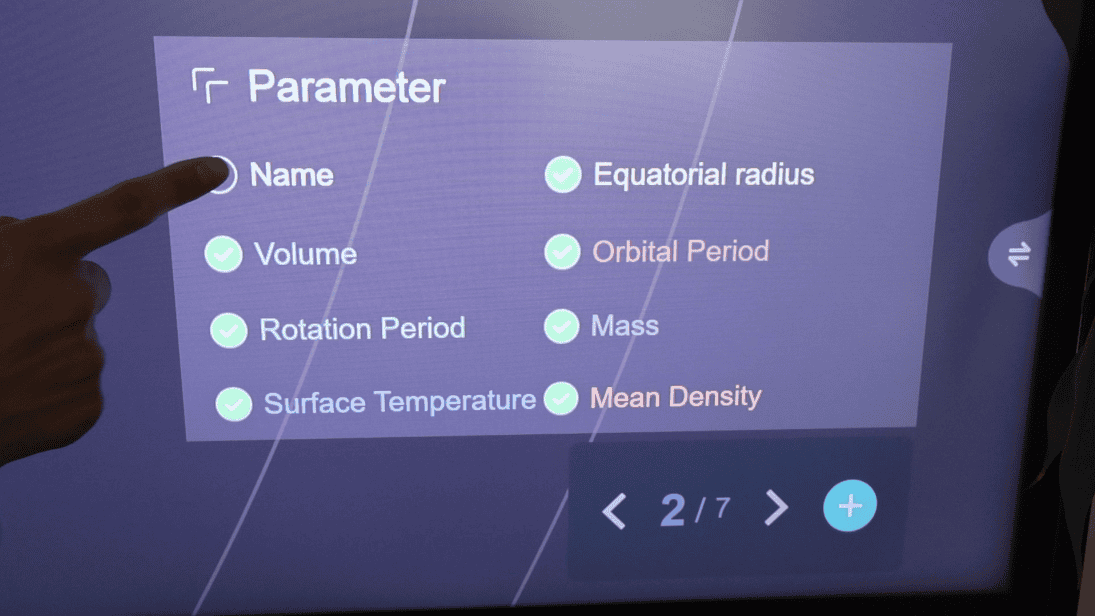
Show or hide the data associated with each planet directly on the interactive solar system map.
- To do this, click on the Parameter button at the bottom right of the map to open the settings panel.
- Check or uncheck the information you want to display or hide.
For more articles on Iolaos (↑)
- Iolaos Tutorial No. 1: Preparing Your First Teaching Materials on Iolaos (PC)
- Iolaos Tutorial No. 2: Creating Interactive Exercises for Your Classroom Interactive Display
- Teach Writing on the Interactive Display with Iolaos Whiteboard Software
- The Hidden Features of Maps in iolaos (Geography and Life Sciences)
- Using a Document Camera with the Iolaos Whiteboard Software
- Teaching Math with Iolaos Tools (1/2)
- Teaching Geometry with Iolaos Tools (2/2)
- Studying an Image in Class with the Iolaos Whiteboard
- Opening Flipchart Files on the Iolaos Whiteboard Software
- IOLAOS : the 3 advantages of our new educational software for teaching on a Speechi interactive display
Published on 26 August 2025
